 https://lapisit.com.au/wp-content/uploads/2024/08/Lapis-HC-Blog-post-snippet.png
1920
1920
Hana Rellosa
https://lapisit.com.au/wp-content/uploads/2021/08/LapisLogo-Header-300x138.png
Hana Rellosa2024-08-02 10:10:282024-08-21 18:12:48Health Check Blog
https://lapisit.com.au/wp-content/uploads/2024/08/Lapis-HC-Blog-post-snippet.png
1920
1920
Hana Rellosa
https://lapisit.com.au/wp-content/uploads/2021/08/LapisLogo-Header-300x138.png
Hana Rellosa2024-08-02 10:10:282024-08-21 18:12:48Health Check BlogThe Challenge
Integrating a wealth of data
Geoscience NSW engaged Lapis via our parent company Spatial Vision to design and develop a new version of their existing ArcIMS-based system, “MinView” with a range of functional and system updates and improvements to benefit users and Geoscience NSW.
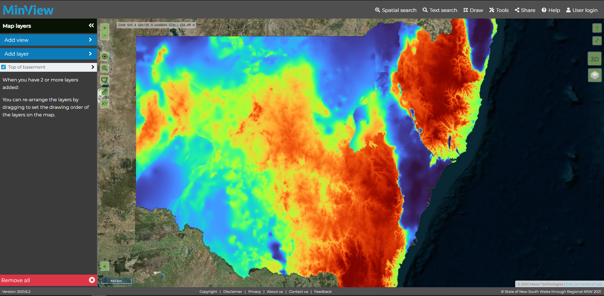
The system allows anyone to visualise detailed geological information for NSW, including aerial photos, geological maps, geophysical data, mining leases, active and derelict mines, microfossils and more.
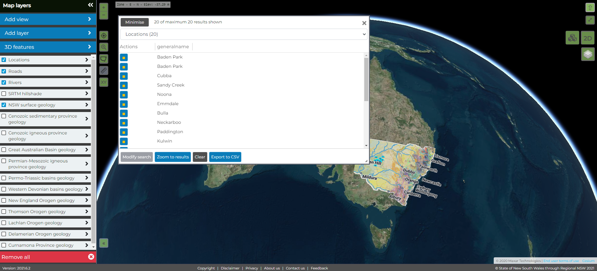
MinView needed to provide a comprehensive range of spatial functionality including 3D viewing, in a responsive web design which is fully tablet and touch enabled. This was to be built on open source technologies and include GeoServer and Open Layers.
With several audiences, the system needed to be able to provide powerful data outputs as well as provide a layered interface that enabled it to be used both by experienced GIS users and those who needed a more simple way to engage with the data.
In addition to the improvements in the functional specification, Geoscience NSW required a seamless transition from the old to new system and an “uptime” assurance from Lapis.
Need to bring together complex data?
The Approach
An adaptive user experience
Applying our mapping and geospatial expertise along with our experience in systems and technology development, Lapis was able to develop the system to meet the specific brief.
Understanding and balancing the needs, skill levels and expectations of different users, considerable user interface and user experience design work was undertaken to ensure an attractive and engaging interface, suitable for both experienced GIS users and those business users who “just want to get the information”.
Built on open source technologies, including GeoServer and Open Layers, MinView provides a comprehensive range of spatial functionality including 3D viewing, in a responsive web design which is fully tablet and touch enabled.
To deliver the project on time and on budget, Lapis applied a proven agile development framework.
The Results
A seamless transition
Since the updated MinView was launched, Geoscience NSW has confirmed that they have received a very positive response from users across differing skill levels and were delighted with the seamless transition that Lapis orchestrated from the old to the new system.
In summary, through the new system and our development approach, Lapis has delivered a set of benefits including providing users with enhanced functionality and the ability to:
- Search, find and add a wide range of geoscience related map layers
- Add their own data to the map, whether from services or uploaded files
- Save, retrieve and share map views
- Query and search map data, including in 3D
- Add their own drawing to the map to highlight areas of interest
- Print the current map to PDF or image formats
- Integrate with a range of Geoscience NSW services including data downloads and automated alerts of title changes
