 https://lapisit.com.au/wp-content/uploads/2024/08/Lapis-HC-Blog-post-snippet.png
1920
1920
Hana Rellosa
https://lapisit.com.au/wp-content/uploads/2021/08/LapisLogo-Header-300x138.png
Hana Rellosa2024-08-02 10:10:282024-08-21 18:12:48Health Check Blog
https://lapisit.com.au/wp-content/uploads/2024/08/Lapis-HC-Blog-post-snippet.png
1920
1920
Hana Rellosa
https://lapisit.com.au/wp-content/uploads/2021/08/LapisLogo-Header-300x138.png
Hana Rellosa2024-08-02 10:10:282024-08-21 18:12:48Health Check BlogThe Challenge
Advanced functionality for Victorian agribusiness
Agriculture Victoria Services is the commercial interface between the Department of Jobs, Precincts and Regions (DJPR) and private industry. The Department supports Agriculture Victoria to achieve wide range of responsibilities including; agriculture development, food production, research, administering funds, grants and programs, and shaping policies and programs to drive the ongoing growth of Victorian agribusiness.
To encourage investment in Victorian agriculture, Lapis was commissioned by DJPR to design and develop a new website to promote investment in the sector, to local and international investors.
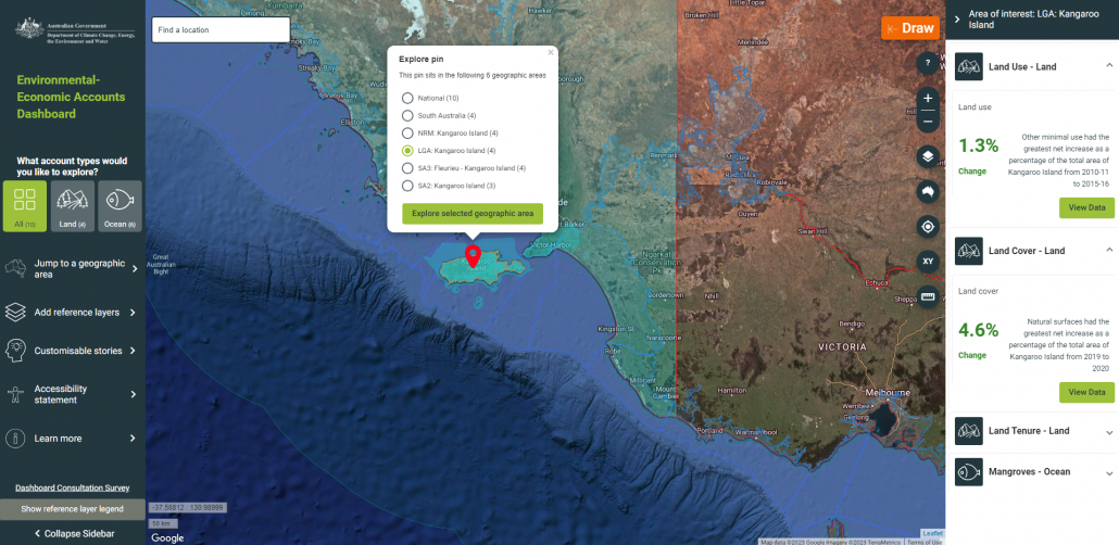
A key requirement of the website was the integration of specialist mapping functionality and geospatial information to provide a significantly enhanced user experience.
Although the core principles of developing a website are fairly universal, the specific requirements of DJPR to include advanced functionality meant that their new website required the specialist expertise of both Lapis and Lapis’ parent company Spatial Vision.
The requirement for advanced functionality also meant that the development approach needed to be tightly controlled in order to meet the project timelines and budget.
Interested in advanced capabilities?
The Approach
Flexible and data-driven
In line with our proven process, Lapis worked closely with the project team from DJPR. The client project team included stakeholders from key operational functions within the organisation and Lapis was able to work collaboratively, applying our collective expertise to meet the brief and deliver the required project outcomes.
The rich content and map data were required to be easily updatable by the client once the website was released. Lapis designed a “data driven” approach which modelled the web structure and defined it in a configuration file, allowing new regions and industries to be easily added.
Rich content is stored in a set of HTML and related files held in an Amazon S3 “bucket” and spatial and related data is held in a PostgreSQL database and served via the open source GeoServer software.
“Our project team and stakeholders are really pleased with how the website and map has turned out. It looks great, functions well, and has drawn praise ranging from front line staff up to our executive. Feedback includes: ‘The website and these documents look terrific and will be a really useful resource for a range of forums.”
Peter Parbery, Manager, Social Research Team, Agriculture Industry Rural Transition, Department of Economic Development, Jobs, Transport and Resources
Lapis worked with the client’s graphic designers to implement an attractive and highly usable web interface which responsively works on desktop and mobile browsers
The solution brought together a complex custom back-end with a user-friendly interface that was encapsulated in a robust and efficient digital ecosystem hosted in the cloud.
The Results
Successfully attracted investment
DJPR confirms that the new website has been successful in attracting investment in Victorian agriculture, from the local market and from overseas investors.
The website comprises a rich set of content including an interactive map showing agricultural resources and production statistics. A wealth of statistical and activity data is available via the map, sources from the ABS, ABARE and other sources. Most is mapped against SA2 boundaries. The map also provides a wide range of contextual map data and standard functionality such as searching and adding user data.
The website was launched in 2018. It is hosted and supported by Lapis in our AWS cloud account and continues to perform to expectations.
Other benefits include:
- Increasing operational efficiency, productivity and agility
- Making extensive information accessible and interpretable with advanced mapping
- Flexible application with room for new regions and industries to be easily added


